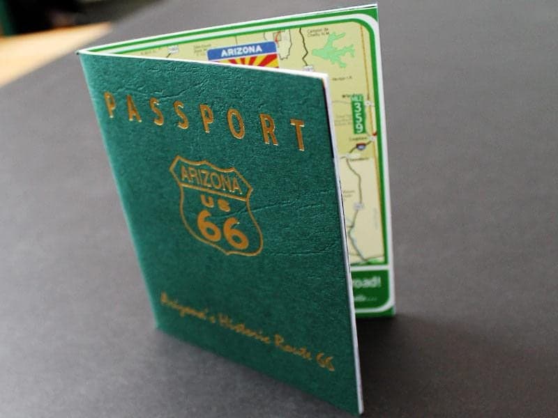
Arizona Passport 66
This passport celebrates Arizona's 100 years of statehood and it's story

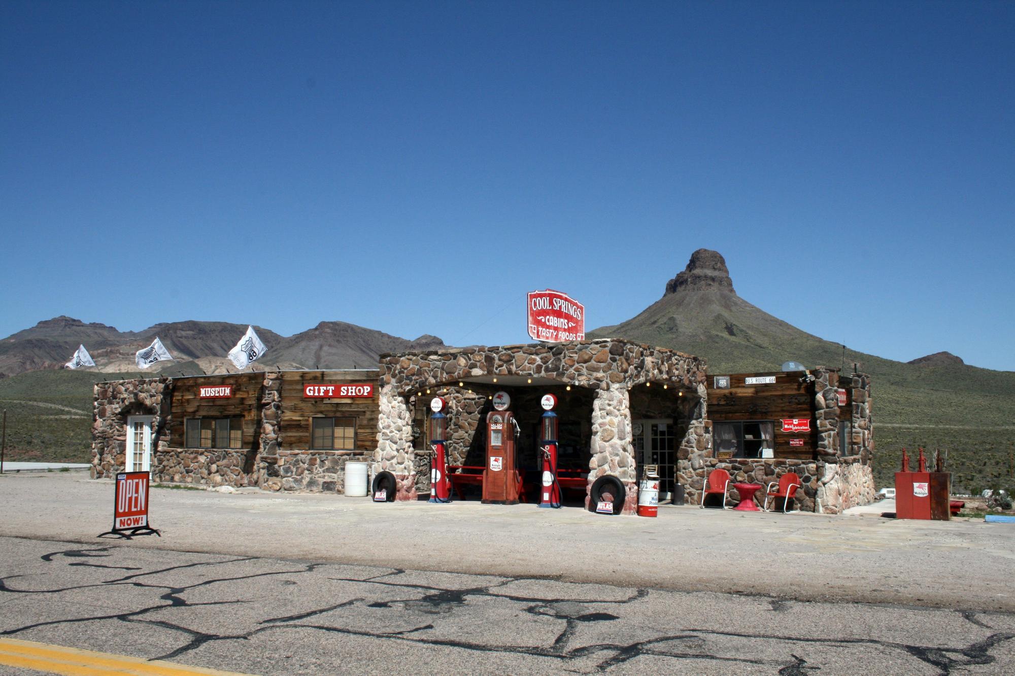
Cool Springs
Cool Springs is a former gas station turned museum / gift shop. Cool Springs is a 30 minute drive (20 miles, 32 km) west of Kingman on Historic Route 66.

Sitgreaves Pass
The switchbacks in Sitgreave's Pass offer awe-inspiring views of unique formations and backcountry roads. This section of the road is about 3 miles west of Cool Springs, 23 miles (37 km) west of Kingman.

Oatman Road Wreckage
At every twist on this historic road, one can see car parts and signs of wreckage. At one point, this was one of the deadliest highways in America. Some motorists would hire local drivers to transverse the back-country roads for them.

Oatman Road Cemetery
Here lies memories and memorials to those who have lived for, or longed for, Route 66 and the dream it represents. The Cemetery is on Historic Arizona Route 66 about 25 miles (40 km) west of Kingman, about a 40 minute drive.

Oatman Road Cemetery Black Mountains Overlook
Here lies memories and memorials to those who have lived for, or longed for, Route 66 and the dream it represents. The blue hills in the background rise up from the west banks of the Colorado River in Nevada. The Cemetery is on Historic Arizona Route 66 about 25 miles (40 km) west of Kingman, about a 40 minute drive.

Sunset on Route 66
This picture was taken at sunset between the Grand Canyon Caverns and Peach Springs on Route 66.

Peter showing barrels of Run to visitors

Mohave Museum of History & Arts wall mural
The walls of the Mohave Museum of History & Arts have murals on three sides.
Previous
Next
Kingman is at the Heart of Route 66 and the longest continuous ribbon (158 miles, 254km) of Historic Route 66 in the U. S. Stretching from the Colorado River to just west of Ashfork, this All American Road makes for a fantastic road trip, especially at this time of year.
The 52 miles (84km) between Kingman and the Colorado River near Topock is the original Mother Road. Predating the declaration of Route 66 in 1926, it was cut to pour in a stream of prospectors looking to stake a claim in the Oamtan Gold Rush of 1902. It is representative of the Mother Road mentioned in John Steinbeck's "Grape's of Wrath" and best symbolizes the Route 66 during the American Great Depression of the 1930's.
Between Cool Springs and Oatman, motorists will encounter switchbacks and some of the most interesting and scenic landscapes anywhere on Route 66. Traveling this country back road is not recommended for RV’s. These hairpin turns and skinny lanes are some of the best relics from America’s story of traveling west, giving a true glimpse of what roadies endured going through the untamed American West. Many remnants of iron wagons can be seen down the hillsides and in the gullies.
Just over Sitrgeave’s Pass, a small graveyard has evolved organically with memorials to those who passed on the Route or whose life dream it was to go  there. Route 66 rolls through Gold Road, which has many foundations and short rock wall remains of the small structures that once made up a town. Nowadays the townsite has been overtaken by a mining operation and one cannot stop and stroll through the remains, but it is possible to stop just outside of town and take a short trek on former alignements of Route 66 and see the country as prospectors and Oakies would have seen it 80-100 years ago.
 The living ghost town of Oatman, a former mining town that hasn’t changed much since it was birthed with a gold rush in 1902. Of course, the burros no longer work the mines, but walk the streets working for carrots from passersby. Stop in midday any day of the week that the sun shines and you’re likely to see a shoot out (reenactment of course). The little curio shops are a fun browse, and there’s even an opportunity to do a little gold panning.
Just past Oatman, one will find Boundary Cone, a unique mountain formation jutting up into the sky, and rolling road heading down toward the Colorado River. 
By 1952, America’s love affair with big cars won over, and Route 66 was rerouted to the current alignment of I-40.
Plan for 1.5 hrs of drive time between Kingman and Topock, plus additional time to stop, take pictures and see the sights. Speed limits range from 25-45 mph (40-72 km/h).
The 87 miles (140km) from Kingman to Seligman is iconic 1950's-60's Route 66. This stretch is similar to what most American's remember on 1950's and 1960's family road trips out west to the Grand Canyon or California.
 Before leaving town. Be sure to stop by the Kingman Airfield for a unique display at the Army Airfield Museum and a tour of Desert Diamond Distillery. D3 has a tasking room and offers tours of the facility, where you can smell the aroma of fermenting molasses and see the oak barrels of their award winning rum before imbibing.
There are several small attractions that visitors enjoy on this stretch. Some favorites include the Hackberry General Store, Keepers of the Wild Animal Sanctuary and one of the original Route 66 roadside attractions - the Grand Canyon Caverns.
The speed limit is 65 miles/hour (105km/h) on the open road. In town, it slows down to 25 or 35 mph (40-56 km/h). I would plan for 1.5-2 hrs of drive time, plus time to see the sights. This road is RV friendly.
You would get the best experience driving both sections of the Mother Road. Either way, you'll want to stop by and see the Route 66 Museum in the Kingman Powerhouse Visitor Center (120 W. Andy Devine Ave, Kingman, AZ). This museum wonderfully represents the creation and evolution of Route 66. While there ask for an Arizona Route 66 Passport, or drop in any of the visitor centers along Route 66 in Arizona and pick one up!